Search -
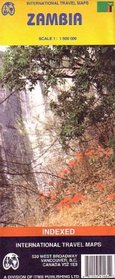
Zambia Map (Travel Reference Map) (Travel Reference Map)
Zambia Map - Travel Reference Map
Author:
Road and travel map. Scale 1:1,500,000. Distinguishes roads from primary paved roads to unpaved roads and tracks, with distances in kilometers. Color changes show elevations. Shows airports, ports, and ferries; points of interest; archaeological sites; vistas; information centers; museums; hotels, bungalows, campsites, and other accommodations; ... more »
ISBN-13: 9781553414643
ISBN-10: 1553414640
Publication Date: 1/1/2005
Pages: 1
Edition: 3rd
Rating: ?
ISBN-10: 1553414640
Publication Date: 1/1/2005
Pages: 1
Edition: 3rd
Rating: ?
0 stars, based on 0 rating
Genres:
- Reference >> Atlases & Maps
- Travel >> Africa >> Zambia


