Search -
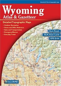
Wyoming Atlas Gazetteer, Fourth Edition
Wyoming Atlas Gazetteer Fourth Edition
Rely on the Wyoming Atlas & Gazetteer for the utmost in trip planning and backcountry access. Contains topographic maps with unbeatable detail, plus gazetteer information on great places to go and things to do. Scale equals 1:250,000 or 1"=4 miles. Contour Interval is 300'. Each page covers 38 miles x 51.8 miles and includes, GPS Grids & t... more »
Rely on the Wyoming Atlas & Gazetteer for the utmost in trip planning and backcountry access. Contains topographic maps with unbeatable detail, plus gazetteer information on great places to go and things to do. Scale equals 1:250,000 or 1"=4 miles. Contour Interval is 300'. Each page covers 38 miles x 51.8 miles and includes, GPS Grids & t... more »
ISBN-13: 9780899333380
ISBN-10: 0899333389
Publication Date: 1/1/2001
Rating: ?
ISBN-10: 0899333389
Publication Date: 1/1/2001
Rating: ?
0 stars, based on 0 rating
Genres:
- Reference >> Atlases & Maps >> Atlases & Gazetteers
- Reference >> Atlases & Maps >> United States
- Travel >> United States >> States >> Wyoming >> General


