Search -
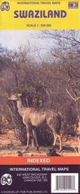
Swaziland Map by ITMB (Travel Reference Map)
Swaziland Map by ITMB - Travel Reference Map
Author:
Road and travel map in subtle colors. Differentiates seven levels of roads from paved highways to unpaved minor roads. Approximate distances in kilometers. Distance chart with many towns. Railways, airports, aerodromes, small aircraft facilities. Gasoline / petrol stations, post offices, bus stations, hospitals / medical facilities, border ... more »
ISBN-13: 9781553414179
ISBN-10: 1553414179
Publication Date: 3/1/2004
Pages: 1
Reading Level: Ages 4-8
Rating: ?
ISBN-10: 1553414179
Publication Date: 3/1/2004
Pages: 1
Reading Level: Ages 4-8
Rating: ?
0 stars, based on 0 rating
Genres:
- Reference >> Atlases & Maps
- Travel >> Africa >> Swaziland


