Search -
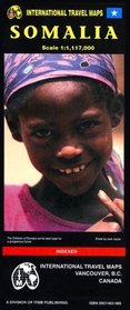
Somalia Map
Somalia Map
Map of the country and portions of its neighbors with elevations shown by color changes. Legend locates international and district boundaries; settlements from major cities to villages; roads (with approximate distances in kilometers) from primary paved roads to other roads or tracks; trails; airports and airfields; ports; gasoline; medical fac... more »
Map of the country and portions of its neighbors with elevations shown by color changes. Legend locates international and district boundaries; settlements from major cities to villages; roads (with approximate distances in kilometers) from primary paved roads to other roads or tracks; trails; airports and airfields; ports; gasoline; medical fac... more »
ISBN-13: 9780921463689
ISBN-10: 0921463685
Publication Date: 1/1/2000
Pages: 1
Rating: ?
ISBN-10: 0921463685
Publication Date: 1/1/2000
Pages: 1
Rating: ?
0 stars, based on 0 rating
Genres:


