Search -
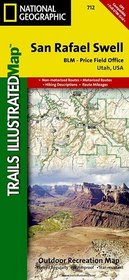
San Rafael Swell, Utah - Trails Illustrated Map # 712
San Rafael Swell Utah Trails Illustrated Map 712
Author:
Coverage includes San Rafael Reef; Green River, Huntington, Castle Dale; Muddy Creek and San Rafael River; Upper and Lower Black Box; the Chute; Cedar Mountain; the Wedge; Sids Mountain Wilderness Study Areas: San Rafael Reef, Crack Canyon, Muddy Creek, Devils Canyon, Sids Mountain, Mexican Mountain, Goblin Valley State Park; Cleveland-Lloyd Din... more »
ISBN-13: 9781566953313
ISBN-10: 1566953316
Publication Date: 9/1/2005
Edition: 3
Rating: ?
ISBN-10: 1566953316
Publication Date: 9/1/2005
Edition: 3
Rating: ?
0 stars, based on 0 rating
Publisher: Natl Geographic Society Maps
Book Type: Map
Members Wishing: 0
Reviews: Amazon | Write a Review
Book Type: Map
Members Wishing: 0
Reviews: Amazon | Write a Review


