Search -
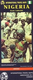
Nigeria Map
Nigeria Map
Author:
Map of the country and portions of its neighbors with elevations shown by color changes. Legend locates international and district boundaries; border crossings; settlements from major cities to walled villages; roads (with distances in kilometers) from freeways to minor roads and tracks; railways; ferries; airports and airfields; rivers, stream... more »
ISBN-13: 9781553413516
ISBN-10: 1553413512
Publication Date: 1/1/2000
Pages: 1
Rating: ?
ISBN-10: 1553413512
Publication Date: 1/1/2000
Pages: 1
Rating: ?
0 stars, based on 0 rating
Genres:
- Travel >> Africa >> Niger & Nigeria


