Search -
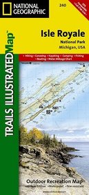
Isle Royale National Park, MI - Trails Illustrated Map #240 (National Geographic Maps: Trails Illustrated)
Isle Royale National Park MI Trails Illustrated Map 240 - National Geographic Maps: Trails Illustrated
Author:
The map includes Isle Royale, Washington Island, Grace Island, Johns Island, Thompson Island, Amygdaloid Island, Belle Island, Passage Island, Windigo, Minong Ridge, Greenstone Ridge, Feldtmann Ridge, Malone Bay, Siskiwit Lake, Lake Richie, Chickenbone Lake, Moskey Basin, Rock Harbor, and much more. Includes UTM grids for use with your GPS unit.
ISBN-13: 9781566953672
ISBN-10: 1566953677
Publication Date: 9/1/2006
Pages: 2
Edition: 4
Rating: ?
ISBN-10: 1566953677
Publication Date: 9/1/2006
Pages: 2
Edition: 4
Rating: ?
0 stars, based on 0 rating
Publisher: Natl Geographic Society Maps
Book Type: Map
Members Wishing: 0
Reviews: Amazon | Write a Review
Book Type: Map
Members Wishing: 0
Reviews: Amazon | Write a Review
Genres:
- Reference >> Atlases & Maps >> World
- Travel >> United States >> States >> Michigan >> General


