Search -
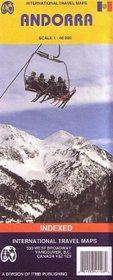
International Travel Maps, Andorra, Scale 1:40 000: Indexed (Travel Reference Map)
International Travel Maps Andorra Scale 140 000 Indexed - Travel Reference Map
Author:
Detailed travel map of Andorra shows roads from national highways to unpaved tracks; pedestrian paths and trails; railways; attractions; summits with altitude in meters; settlements; isolated buildings; sports fields; swimming pools; parking; hospitals; scenic vistas; Alpine huts; refuges; mountaineering, climbing, and absailing (cliff descent);... more »
ISBN-13: 9781553411086
ISBN-10: 1553411080
Pages: 1
Reading Level: Ages 4-8
Rating: ?
ISBN-10: 1553411080
Pages: 1
Reading Level: Ages 4-8
Rating: ?
0 stars, based on 0 rating
Genres:
- Reference >> Atlases & Maps
- Travel >> Europe >> Andorra


