Search -
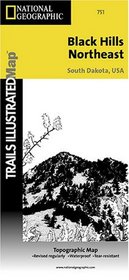
Black Hills - Northeast, South Dakota Trails Illustrated Map #751
Black Hills Northeast South Dakota Trails Illustrated Map 751
Author:
This Trails Illustrated topographic map for South Dakota's Black Hills, Wind Cave National Park, Mt Rushmore, and surrounding area, is the perfect map for exploring this magical wilderness. — The map includes Wind Cave National Park, Custer State Park, Black Hills National Forest, Norbeck Wildlife Preserve, Sylvan Lake, Stockade Lake, Legion Lake... more »
ISBN-13: 9781566953795
ISBN-10: 1566953790
Publication Date: 1/1/2001
Edition: 2
Rating: ?
ISBN-10: 1566953790
Publication Date: 1/1/2001
Edition: 2
Rating: ?
0 stars, based on 0 rating
Publisher: Natl Geographic Society Maps
Book Type: Map
Members Wishing: 0
Reviews: Amazon | Write a Review
Book Type: Map
Members Wishing: 0
Reviews: Amazon | Write a Review


